J Harry Rich State Forest

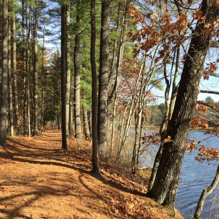
The J. Harry Rich State Forest is one of Groton’s largest open space parcels. It offers a network of mostly wide dirt roads and some single-track trails, stunning riverside views, and supports rich ecological diversity along the Nashua River.

The forest includes broad old logging roads and narrower foot trails that wind through white pine stands. The Nashua River borders the forest’s western edge. The main J. Harry Rich Trail is about 1.5 miles long. It starts at Nod Rd. and ends at the Nashua River Rail Trail. To the west of the main trail is the floodplain. Two large loop trails west of the main trail (Oxbow Loop and Eagle Loop) offer beautiful riverside trails. South of the main trail is a single-track trail that connects to the handicap accessible John Tinker Trail and Nashua Riverwalk.

Size: 519 acres

Owner: DCR – Division Of State Parks And Recreation

History

The original forest area was settled around 1656 by English farmers. One of the original Selectmen of Groton was John Tinker, and he ran a trading post for a short period of time that was near where Nod Brook enters the Nashua River. This area of Groton was cultivated from colonial times until the middle 1800’s when it was abandoned. The land then reverted to a forest. The property was eventually purchased by the Lawrence family in 1890. They created a small White Pine plantation. In 1918, the East Pepperell dam was built. The dam flooded roughly 140 acres of the property and created Pepperell Pond, which now abuts Rich State Forest. From 1923 to 1952, J. Harry Rich, a Professor-Emeritus of Forestry at the University of Massachusetts, acquired the present amount of forest acreage. Through forest management, he established a forest of predominantly White Pine. In 1956, the forest, under Professor Rich’s ownership, was dedicated as a certified Tree Farm. The forest continued to be managed by Professor Rich until his death in 1964. Subsequently, the title was transferred to the Rich Tree Farms and Forestry Corporation. Under both Professor Rich’s and the Corporation’s ownership, the forest was silviculturally managed and produced four million board feet of timber and 2,000 cords of fuelwood. The Commonwealth of Massachusetts purchased the forest in 1981. It is managed now by the Department of Conservation and Recreation (DCR) out of their Willard Brook Headquarters in W. Townsend, MA.

Directions

Main parking area is along Nod Rd. at Common St.

Map(s)

Map Goes Here
Click a label for more information. Click and drag to scroll. Zoom in to separate overlapping labels.

Private paths are shown in light gray. Please stay on paths and respect private property on these trails.
 Parking

 Trailhead

Nearby Places


Nashua River Rail Trail

The Nashua River Rail Trail is perfect for family-friendly outdoor activities including bicycling, skating, running, and scenic casual walks. Like other trail trails, it has a level 2% grade, rising at the Pepperell (north) end. The section of the rail trail in Groton passes ponds, wetlands, drumlins, and various types of forested areas. The trail...
Learn more

Cronin/Longley I & II

Two miles of single-track trails connecting Longley I, Cronin, and Longley II CAs and Nashua River Rail Trail. Glacial river delta sand dune on Longley I is large and has steep trails to the top.
Learn more

Shepley Hill

Shepley Hill, formerly an equestrian estate where horses destined for the Olympics once competed, has multiple loop trails traversing over and around a drumlin,. Outer loops are mostly level, and other trails go up and over the crest of the drumlin. This property can be accessed via the Nod Road parking for the Nashua River...
Learn more

Difficulty

Easy

Cautions

After heavy rains, particularly in the spring, nearly all trails in the forest can become impassable.