Ice Line Trail
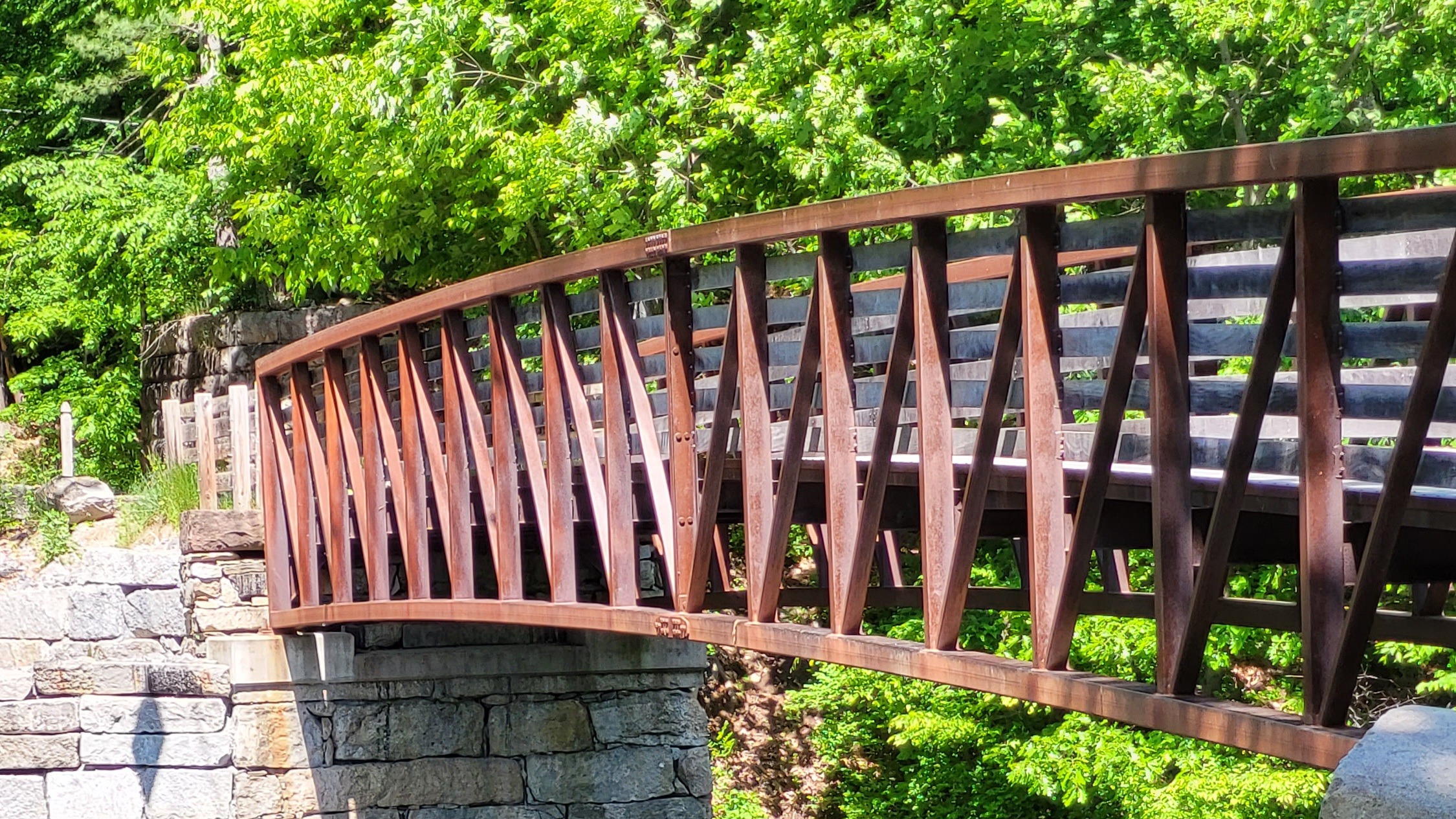
This former railroad bed is level and runs alongside agricultural fields and wetlands. From this trail you can veer off onto trails that connect to other GTN properties. At the west end of this trail you will arrive at Fitches Bridge, a pedestrian bridge over the Nashua River.
Note: The Fitches Bridge is not passable as heavy rains caused the retaining wall to collapse from the extra weight that built up behind the wall.
This trail is the right-of-way of the old Brookline and Pepperell Railroad that starts at the main line to Ayer at Squannacook Junction south of the Groton Town Forest and heads north through Pepperell (along the west side of the Nashua River) and then ended in Brookline NH at the eastern shore of Lake Potanipo. The Ice Line Trail has several distinct sections. Going north from the main line to Ayer, the trail is a narrow dirt road for about ¾ of a mile. It then turns into “Newell’s Crossing”, which is the dirt and gravel road used by the West Groton Water District to access their pump house, which intersects Rte. 225 (W. Main St.). On the other side of the street, the Ice Line Trail continues north along the paved driveway to The Groton Center parking lot and then becomes a single-track dirt trail for about 1/4 mile that ends at the paved Spencer Circle. After another 1/8 mile, it crosses Hill Rd. and goes down a short steep hill to an alternating single track/double track dirt trail that goes roughly 1.3 miles to Fitch’s Bridge. The Shattuck Farm is on both sides of the trail over most of this distance. Two trailheads on the western side of the Ice Line Trail connect to the Johnston Conservation Area around 0.8-0.9 miles north of Hill Rd. A short path to Wallace Rd. is on the west side of the Ice Line Trail about 1.1 mile north of Hill Rd.