
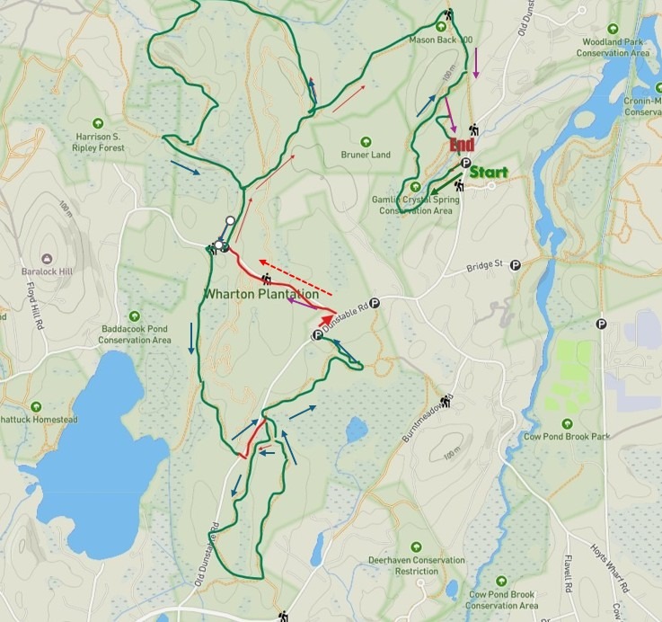
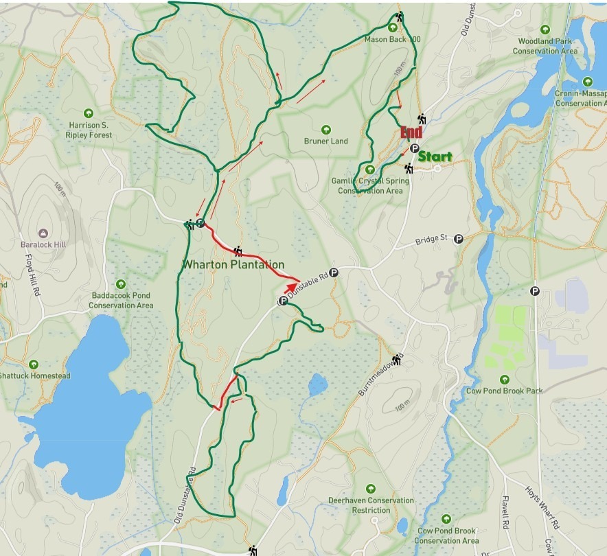
Long Hikes: Northeast Region
Total length: about 7 miles. Estimated time: about 4 hours.
Description: Starting at the Gamlin Crystal Springs parking lot on Old Dunstable Road, go left on the Indian Rock Trail. Soon you’ll be walking along a pond full of wildlife and then you will approach Indian Rock. Be sure to take the little yellow loop trail: there’s a bench for viewing on the top and on the way down, you pass by a porcupine cave. Back on the main trail, follow it over a a couple of bog bridges until you see a yellow loop marker. Go left up the upper Boulder Trail. The trail is named for all the erratics left behind by the glaciers. Look for two old quarry sites along the away. Just after the you reach the second (higher) quarry, follow the trail on the left over to Mason Back. Once on Mason Back hill go left and look for a cellar hole and chimney from an old hunting camp. Go left and follow the connector trail for a half a mile over to The Wharton Plantation.
Once in Wharton, go right on the Dan Parker Road. Look for old farm stone walls and a nice pond on your right. Follow the path until you see the second yellow marker and go left. The loop trail passes several ponds. Be on the lookout for Great Blue Herons in the spring and summer. The trail loops around a Heron Rookery and then follow the trail markers up a switchback that takes you over an esker to a large bog bridge by a beaver lodge. Follow the trail back to the Dan Parker Road and go right until you reach a parking area on Martins Pond Rd./Rocky Hill Rd. Then go right for about 50 yards and the trail continues on the left up an esker and down to Baddacook Pond (a marked excursion down the pond). Back on the main trail, continue until you reach a parking area on Old Dunstable Road. Go left, about 100 feet and cross the road over into Wharton’s Burt Meadow trails. As you pass the trail head, you’ll notice a wildflower meadow. This meadow scaping was done by a group of volunteers to naturalize NEFF’s logging area from a few years back. Follow the yellow trail to the right and it will bring to the main trail that takes you to the other side of Burnt Meadow. Take a right onto this trail (about 100 yards before the wildflower meadow). Follow the trail to a split and go left to the first connector trail that takes you out to Old Dunstable Road. Go right and take the first left on Rocky Hill Road (a dirt road).
Back at the Wharton Planation parking area go right onto Dan Parker Rd, but this time go straight up Dan Parker Road until you see the cutover sign to Mason Back. Go right on Mason Back and cut back over to Gamlin on your right. This time as you approach the quarry, follow the white/green markers that take you back down the hill to the starting point.
Note: A highlighted map is provided below. We also recommend using the interactive map found on the home page and turn on the tracker for your location. Other longer hikes can be found by searching the site for “Long Hikes”